
5.0 Magnitude Earthquake Strikes Near Miami, Texas: What You Need to Know
A rare 5.0 magnitude earthquake struck near Miami, Texas, on July 23, 2026, the strongest in the Texas Panhandle in over 100 years, with no immediate reports of damage.
Tropical Depression Bertha weakens near Houston but its moisture fuels a flood threat in the East. Get the latest tracker update and impact on Texas.
Tropical Depression Bertha, once a tropical storm that made a second Gulf Coast landfall on July 23, has weakened but is far from done. As of Thursday evening, the system was located 10 miles north-northeast of Houston, still delivering rain to parts of eastern Texas. However, the most significant flood threat is unfolding hundreds of miles away, where a plume of tropical moisture from Bertha is feeding heavy rain along a cold front across the Southeast.
Residents in Houston and along the Texas coast should monitor local forecasts for heavy downpours, while those in the Southeast should prepare for ongoing flood risks. AccuWeather's Tony Laubach reported live from the Texas coast as Bertha moved inland following its second landfall, highlighting the immediate impacts on the region.
Though Bertha is now a depression, its remnants may still spark heavy downpours in eastern Texas. Bertha's remnants could bring 1 to 3 inches of rain, with isolated totals of 4 inches, to a few areas along the middle Texas Gulf Coast and in surrounding areas. This rainfall, while not extreme, could still cause localized flooding, especially in low-lying or urban areas with poor drainage.
For those looking for a latest Houston weather forecast update, the immediate concern is the potential for flash flooding from these downpours. The system's slow movement and abundant moisture mean that even moderate rainfall rates can accumulate quickly.
The more serious flood threat is now in the East. A plume of tropical moisture linked to Bertha is feeding soaking rain along a cold front draped across the Southeast. That moisture will continue to fuel a flooding rainfall threat through Friday from North and South Carolina to northern parts of Georgia and Alabama, potentially causing more flooding there than in areas closer to Bertha itself.
Some areas in North Carolina have already received a month's worth of rain in just a few days with more to come. Heavy rain Thursday morning prompted flash flood warnings in southeast Virginia, eastern North Carolina, and eastern Tennessee. Flooding closed a short section of Interstate 40 northwest of Durham, North Carolina, Thursday morning that has since reopened, according to the state's department of transportation.
Flash flood warnings were also issued in North Carolina, including Greensboro and Winston-Salem, Wednesday night, where heavy storms dropped up to 6 inches of rain in 12 hours. There were no flood reports from the area, where a serious drought and prolonged, rather than intense, rainfall has helped mitigate the threat so far.
For those seeking an interactive Bertha tracker for Houston update, the system's center is now inland and weakening, but its moisture plume extends far to the east. Residents in the Southeast should not let their guard down, as the flood risk continues through Friday. The combination of saturated ground and additional heavy rain could lead to significant flooding, especially in areas that have already seen a month's worth of rain.
In the Texas Gulf Coast, the focus remains on the potential for 1 to 3 inches of rain, with isolated higher amounts. While the system is no longer a tropical storm, its remnants still pose a threat. The latest Houston weather forecast should be monitored for any updates on heavy downpours.
Residents in the affected areas should stay informed through local weather services. The flood threat in the East is particularly concerning because the moisture plume is expected to persist through Friday. Those in North Carolina, South Carolina, northern Georgia, and Alabama should be prepared for potential flash flooding, especially in areas that have already received heavy rain.
For the Texas coast, the rain from Bertha's remnants is a welcome sight for some areas that have been dry, but it also brings the risk of localized flooding. The system's slow movement means that rain could linger, increasing the chance of flooding in urban areas.
As Bertha continues to weaken, its legacy will be the flood threat it leaves behind. The system's moisture is now feeding a cold front that will bring heavy rain to the Southeast, potentially causing more flooding there than near the storm's center. Residents in both regions should stay alert and follow the guidance of local officials.
Continue exploring trending topics.
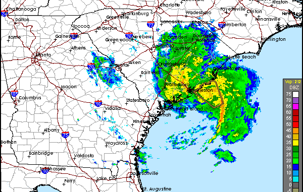
Tropical Storm Bertha weakens but brings heavy rain, strong winds, and coastal flooding to the Gulf Coast, with landfall expected in Louisiana Wednesday.